Showing posts with label river Cale. Show all posts

Wednesday, March 17, 2021

Galatia and Hail

Date:             11th March 2021 

Destination:    Stowell and South Cheriton

Distance:       14.37 miles

Duration:     2 hours 50 minutes

Weather:      9°C sunny intervals, hail, rain and winds of 46mph


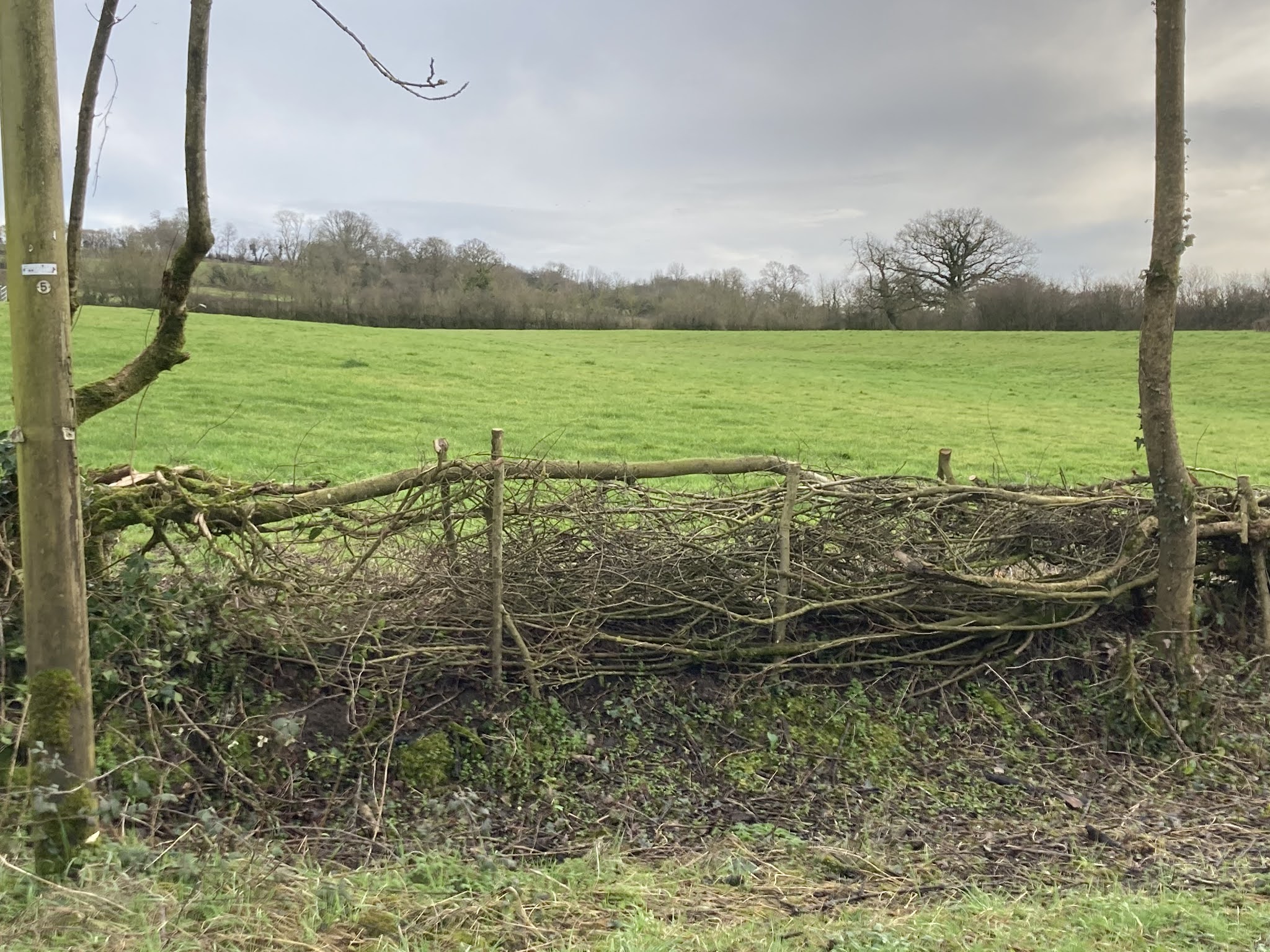
In anticipation of inclement weather, we decided on a circular route we've cycled many times over the last four years.  Although still 14 miles long it was a much shorter ride than the 20+ mile routes we've cycled recently.

The temperature suddenly dropped and it started hailing the moment I sat on my bike ready to go.  Fortunately I was already dressed in waterproofs so decided to start cycling and make my way through Templecombe to hopefully meet JC en route rather than hang around and get cold.   Similarly minded JC appeared no sooner had I rounded the corner.

We nipped through Templecombe Recreation Ground, (Benches at the top of the Rec provide excellent views over the Blackmore Vale) and cycled towards Henstridge Bowden.  The  uphill climb seemed much harder this time, maybe because of a very strong head wind and/or maybe  due to the fact that I was feeling slightly fatigued from my first Astrazenica Vaccination on Sunday 7th March.

Just before Henstridge Bowden the hail stopped and we slowed down to make our way past three tree surgeons at work.  We were advised  that it was okay to pass as they weren't chopping any big trees down at that moment in time. No lengthy delays for us!


Tree Surgeons


After cycling though Bowden we turned right into Shoredown Lane.  A flock of sheep was busy eating their way through a crop of presumably turnips.   An electric fence ensured the sheep only had access to part of the field, although somehow two sheep had found their way into the forbidden area!


At the end of Shoredown Lane we turned left and headed towards Mary Magdalene Church in Stowell. I particularly wanted to look for the grave of Galatia, an African buried in Stowell in 1605.  (Victoria History County of Somerset and Black Tudors by Miranda Kaufmann) Unfortunately there is very little information to be found about Galatia and how she came to be in Stowell.  We couldn't find her grave in the churchyard either.


St Mary Magdalene Church, Stowell


After another hail shower, which saw us sheltering in the Church porch until it passed, we remounted our bikes, summited Windmill Hill and turned left into Cabbage Lane, cycling towards  one of our favourite spots for a refreshment break.  Whenever we pass through Wilkinthroop we sit on a wall looking out over the Blackmore Vale.   We have been coming so often that we are recognised by local residents who stop to chat to us.  On explaining the difficulty we have of identifying Wilkinthroop from Cucklington on the other side of the Vale we were advised  to look for a shed on the horizon.  


A great place to stop. Wilkinthroop


Starting to feel cold we continued on our way down Cabbage Lane, across the A357 and through South Cheriton.  From this point onwards though, the temperature dropped and the rain/hail came in to stay. Rounding the corner at the bottom of South Cheriton we had to take evasive action to avoid ploughing into an alsatian and his owner.    We both swerved to our right to avoid a collision.  My front wheel nearly colliding with JC's rear wheel.


Avoiding a collision


At the end of Batchpool Lane we crossed over Battspool Bridge which spans the River Cale and turned right into Moor Lane.  


Rainy approach to Battspool Bridge, Batchpool Lane


By the time we turned right into Gigg Lane we'd been cycling in the rain  for a few miles.  I had several layers on,  unfortunately JC was only wearing only one pair of goretex trousers and with wet gloves was  feeling the cold.  We now wanted to get back as soon as possible.

We had amazing skies for the first half of our journey today and managed to keep dry between showers, once taking shelter in Mary Magdalene Church, Stowell during a hail shower.  The second half of the journey gave us persistent rain, which led to JC feeling particularly cold towards the end of the journey.  Always great to be out and about cycling whatever the weather but always good to get back to our homes, to a hot shower or bath and a much deserved hot cup of tea.


Monday, March 8, 2021

Constable and Gillingham

 Date                 4th March 2021

Destination     Gillingham Town Bridge and Parnham Mill

Distance         21 miles

Duration         4 hours 15 minutes. 

Weather         6C. Overcast and damp


Inspired by John Constable's paintings of scenes in and around Gillingham in the early 19th Century, our mission today was to cycle to Gillingham Bridge and Purn's Mill, (also known as Perne's Mill or Parham Mill).   Having stumbled upon   Visit Dorset's - Gillingham: A Walking Trail  online, we also hoped to visit some other town landmarks.

We set off  from Templecombe across the north western part of the Blackmore Vale  towards Buckhorn Weston, climbing up Hartmoor Hill to the top of the limestone ridge.  We headed down the other side along Westbrook Road cutting across to Harpitts Lane via  Folly Lane.  Further downhill as Harpitts Lane becomes  Nation Road we found ourselves cycling alongside the River Stour.   

Even though it meant adding another mile to our journey and  Eccliffe was part of our ride last week, we decided on a  detour.   Constable had sketched Eccliffe Mill in 1820,  we therefore felt it had to be included in our Constable themed bike ride.  


Eccliffe Mill

Rejoining our planned route we cycled under the main London Waterloo to Exeter St David's Railway line, continuing our way along Common Mead Lane.  Unwittingly we cycled past the setting for Constable's "The Entrance to Gillingham",  which depicts a view from Common Mead Lane across to St Mary's Church. We turned right into Wyke Road,  negotiated traffic lights at the junction of B3092 and B3081  and headed straight across the junction into the old part of town.

Here we referenced   "Gillingham A Walking Trail" and en route to Gillingham Bridge we looked at the Old Town Lock Up,  Rorty Crankle's two door bells,  the buildings for Gillingham's first bank and Slade Department Store,  Gillingham's oldest pub (Phoenix Inn) and Gillingham Free School, before making our way along the High Street to Gillingham Bridge. 


Shreen Water and Gillingham Bridge

 I'm not sure how much of Gillingham Bridge Constable would recognise today.  The Western part of the bridge depicted in Constable's painting is obscured by a footpath bridge and one of the arches on the eastern side (shown above) of the bridge is also obscured.  A commemorative plaque identifies the bridge as that painted by John Constable in 1823.


Gillingham is a three rivers town.  Shreen Water flows under Gillingham Bridge and through Gillingham Town Meadow, joining the River Stour just before Waitrose.


River Shreen joining River Stour in Gillingham


The  River Lodden  flows past the  eastern side of the town and joins the River Stour south of Gillingham between Eccliffe and Madjeston.  

Perne's Mill is located on the northern edge of Gillingham.  Leaving the town centre we cycled northwards up the B3092 and turned right towards Colesbrook and left into Purns Mill Lane towards Shreen Water. 


Approach to Perne's Mill

 Unfortunately the mill Constable painted in 1823  burnt down and in 1825  a new mill was built,  bearing little resemblance to the original mill.   


Perne's Mill

Leaving Colesbrook we again headed north on B3092 turning left into Kendall Lane and on to  Milton on Stour.  After crossing the River Stour we found ourselves crossing over another body of water,  a River Stour tributary.  Unfortunately I have not been able to discover a name for this headstream.  

Turning right into Field Lane we cycled steadily uphill crossing over the B3081 and on towards Cucklington where we had  a much later than anticipated refreshment break with views over  the Blackmore Vale.


View from Cucklington Bench


Feeling reasonably refreshed (as much as you can be after cycling seventeen miles!) we headed on down School Hill  and into the Blackmore Vale.  Cycling along  Marsh Lane (one of many in the Blackmore Vale)  we noticed a well set back from the road near Marsh Court.  Amazingly this is the first time we'd noticed the well even though we have cycled past it often over the last few years.


Well,  Marsh Lane near Cucklington


On our way back to Templecombe we crossed over the River Cale at Abbey Ford Bridge.  In the early 13th century the Abbess of Shaftesbury gave permission to build a bridge over the river, thus replacing the ford.  Victoria History Somerset Volume vii


Abbey Ford Bridge, Temple Lane


Another long but fascinating and interesting ride.  A veritable voyage of discovery, which will only be truly completed on viewing original Constable paintings of Gillingham and its environs.  


Route


Tuesday, March 2, 2021

Goats and Shadows

Date                  25th February 2021

Destination         Duncliffe Woods

Distance            22 miles 

Duration          4 hours with lots of stops.

Weather         11 °C. Sunshine


After last weeks disorganised start I was ready and waiting for JC this time, with everything charged, adjusted, mounted and stored in preparation for our longest ride to date.    

We set off from Templecombe in an easterly direction towards Buckhorn Weston, pausing briefly on crossing the River Cale.  Water levels appeared to be much lower than we'd seen in previous weeks. 


River Cale


 "I'm the king of the castle get down you dirty rascal." came to mind on seeing Billy Goat Gruff perched on top of a staircase,  his smaller friend on a much lower level.   Various goats  of different sizes were to be found amidst all sorts of paraphernalia, located in a field solely for their entertainment .  The friendly owner on hearing his dog bark and seeing us looking at his goats came out to chat to us and explained how he had acquired the animals and his future plans for them
.

Billy Goat Gruff and one of his friends


Continuing on our way it wasn't too long before we were crossing  the A30 at Bowden and heading towards Fifehead Magdalen, a small hamlet situated on a hilltop overlooking the River Stour.


Crossing over the A30 at Bowden near Gillingham


Previously whenever we have visited  Fifehead Magdalen we have always sat on a grass verge at the top of Fifehead Hill,  that is until we found a much better place to take a break .  The wall to the south of St Mary Magdalen Church offers a much more practical seating arrangement with wonderful views, thus it is here that we rested awhile.


Perfect spot for a break.  

Feeling rejuvenated we continued downhill  crossing the Stour at Trill Bridge.  According to an article in Dorset Echo (Dorset Echo Trill Bridge) Trill Bridge was badly damaged by a large lorry laden with steel girders in June 2018.  It must have taken sometime to remove the lorry and presumably also to repair Trill Bridge.   The Stour  continues on its way around the southern edge of Fifehead Magdalen before turning south to be  joined by the River Cale, Bibbern Brook and River Lydden to the west of Marhull.   

River Stour, Trill Bridge, Todber


Not much further on from Trill bridge we joined the B3092, heading south for few hundred yards before turning left into Shave Lane.

With Duncliffe Woods in sight we cycled towards  Stour Row, stopping en route  to look at an unusual group of buildings.  The main residence and all of its outbuildings were all very colourfully painted.  


Two of the colourful outbuildings


Just before Stour Row we turned left,  making our way up to Duncliffe woods, via Hawkers Lane,  named not because travelling sales people used to come and sell their wares but  because a farm situated on the lane was owned in 1664 by Robert Hawker.   Stour Village History


Duncliffe woods from the other side of the vale

Only half way though our journey with ten miles still to cycle we pressed on along Scotcheney Lane and  Scotcheney Hill crossing back over the A30 at East Stour.  We then found a bench along Witch Lane for our 2nd refreshment break.  It is possible that Wych Elms grew here, hence the name.  Although there is a story of a witch living in East Stour in  "Dorset up Along and Down Along"  or check out the following podcast Alfred Daily   Listen at 21:28 minutes.

Not exactly sure of our route we took a wrong turning at the end of Folly Lane, turning left instead of right.  We soon realised the error of our ways and understood we were possibly not the first to have made a similar wrong turning given the clearly visible signage.


Wrong turning leading to a dead end

Back on track we made our way to Eccliffe Mill, now a private residence.   The River Stour, already joined further upstream by the River Lodden and Shreen Water, divides into two at Eccliffe Mill.  Part of the river passes under the mill whilst the rest of the water is diverted  through a channel and around Eccliffe Mill, with both bodies of water joining forces again further downstream.  

Water diverted around the disused mill


Leaving Eccliffe we made our way steadily up hill along Nations Road and Harpitt Lane. Nearing the top of the hill we paused to listen to a large flock of starlings  roosting above us, hoping they might start murmurating.  Conscious that I wasn't ideally positioned, my decision to move on was made very quickly when my action camera and crossbar bag were suddenly splattered from above.


We walked up the rest of Harpitt Lane,  mounting our bikes at the top of the hill to continue cycling on towards Buckhorn Weston.  As we travelled westwards for the last few miles, I pulled my helmet down as much as I could to shield my eyes from the sun, which was by now very low in the sky.    

We were very lucky with the weather for our ride today.  The sun shone the whole time creating shadowy patterns en route, an inspiration last year for my Christmas present from JC.  A beautiful handmade rug which now has pride of place in my lounge in front of my wood burner.


Handmade Rug  by JC
Inspired by shadows 

When JC and I started cycling we were rather unfit and could only cope with much shorter rides of about six to ten miles.  Over time we have built our fitness up and today we managed twenty two miles making   it from one side of the Blackmore Vale to Duncliffe Woods on the other side and back again, quite an achievement compared to four years ago.


Route


Saturday, January 30, 2021

Wildlife and Floods

22nd January 2021. 


After much rain, Thursday promised to stay dry, as we set off for a leisurely, socially distanced cycle ride across the Blackmore Vale, dressed for the cold weather, with hats, gloves and multiple layers of clothing.  
 
This week the circular route I had planned included Yenston, Marhull, Fifehead Magdalene, Kington Magna, Buckhorn Weston and Templecombe.  As much as possible we try to avoid using main roads, or those with heavy traffic, so to avoid  traffic heading towards Gibbs Marsh Industrial Estate we cut across from Marsh Lane, through Henstridge Airfield and onto Landshire Lane. 

As we cycled along Landshire Lane it was evident that the River Cale had breached its banks and the road was flooded.   Not to be thwarted we pressed on, cycling through the flood.
 

Floods in the Blackmore Vale

With very wet feet we had a brief discussion on where to cycle to next.  We had three options.  Continue East, head back towards the A30 or cycle to Stalbridge.   We ruled out the latter option as it would've meant a much longer route with cold wet feet.   As we were deliberating, a couple of cars/vans stopped to say that they didn’t think we’d get through the next flood around the corner heading East towards Fifehead Magdalene.   A car was stranded in the middle of the flood and we were told the water would reach our knees.  

 It is here that the River Stour briefly comes alongside Landshire Lane.  Amazingly the  Cale and Stour rivers do not meet at this point but a bit further south after the Cale has meandered its way past West Mill Lane, near Stalbridge.  The Stour eventually makes its way to Christchurch and out into the sea.

We thought we’d cycle around the corner to see the extent of the flood for ourselves.  Sure enough there was a car stuck in the middle of the flood and as we looked its hazard lights went out.  Our decision made for us, we retraced our tracks and headed back through the airfield and onto the A30.

Surprisingly the River Cale had also spilled out onto the A30, but fortunately for us it did not cover the whole road.  The central line markings were visible, marking our route through.  We slowly cycled along the middle of the A30 holding traffic up as we did so, until we could safely return to side of the road.  Strangely it was near a bend a little way along the road after the flood that a lorry decided to overtake us.  With another lorry coming the other way I stopped pedalling believing I was going to get cut up.  The lorry coming from the opposite direction also slowed down.  Somehow the overtaking lorry managed to pull back in without any incident!  We turned off the A30 as soon as we could and cycled towards Kington Magna.  

All Saint's Church Kington Magna


Although our feet were cold we thought we could last a while longer so we took ourselves up to All Saint’s Church at Kington Magna, for a much deserved rest, tangerine and drink of water.  There are two benches situated either side of the West facing door overlooking the Vale. (The picture above shows the north facing door)  From this vantage point we could see the recently negotiated flooded A30. 

Feeling rejuvenated we decided to head up onto the ridge and then down Hartmoor Hill to Buckhorn Weston.  This is an exhilarating downhill ride, it's just a shame there is a sharp bend at the bottom to slow you down.  Just after the bend there is a newly laid hedge on the left. 


Newly Laid Hedge, Hartmoor Hill, Buckhorn Weston


The next leg of the journey from Buckhorn Weston to  Templecombe again involved us negotiating flood water from the River Cale and adding to the moisture content of our already wet footwear.

It was along this road that a barn owl flew out in front of us.  We would follow it for a little way then it would disappear before coming back out onto the road again.  This happened three times until it disappeared for the last time near Bow Brook.  An absolutely fabulous experience and our second sighting of a barn owl on our cycling travels.  The first sighting a couple of weeks ago occurred on the road from Wincanton to Buckhorn Weston.  A large barn owl flew over a hedge in front of us and in its talons it held a small creature.  We followed in total awe until it veered off towards some buildings.

As we made our way past Bow Brook we met some mutual friends of ours, out for a walk with their 10 month old dog.  We  stopped for a socially distanced chat and a catch up.  As we departed ways a car driving far too fast  around a corner swerved to avoid us cyclists, ploughed its way through the muddy verge on the other side of the road, before swerving  back onto the road to avoid our friends and their dog. A very close shave and a bit of a dampener (excuse the pun) at the end of an incredibly exhilarating bike ride. 


Map with route marked in black.  Dotted line shows route originally planned.


Purse Caundle and Refurbished Bike

Date:                29th April 2021 Destination: Purse Caundle  and Milborne Port Distance:      15.24 Miles Duration:      3 hours 19 m...